North American Land Change Monitoring System
NALCMS products can be used for a variety of applications, including: carbon sequestration analysis, wildlife habitat mapping, ecosystem monitoring, environmental planning, water quality assessments, and evaluation of biofuels production potential.
The maps produced under this initiative represent land cover in 2005, 2010, 2015, and 2020, and are based on either Moderate Resolution Imaging Spectroradiometer (MODIS) satellite imagery monthly composites at 250 m spatial resolution; Landsat 7-8; or RapidEye satellite imagery at 30 m spatial resolution.
The NALCMS’ nineteen land cover classes are based on the Land Cover Classification System (LCCS) standard developed by the Food and Agriculture Organization (FAO) of the United Nations.
Partner Organisations


Map Files
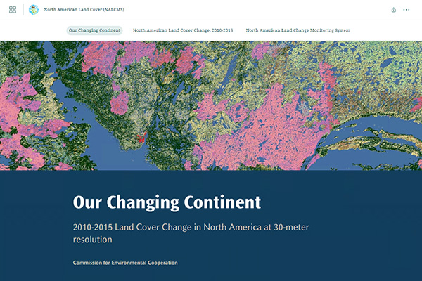
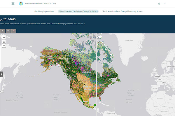
Land Cover Change 30m, 2015-2020 (Landsat)
2024 Land Cover
This map demonstrates land cover change between 2015 and 2020 in North America at a spatial resolution of 30 meters.
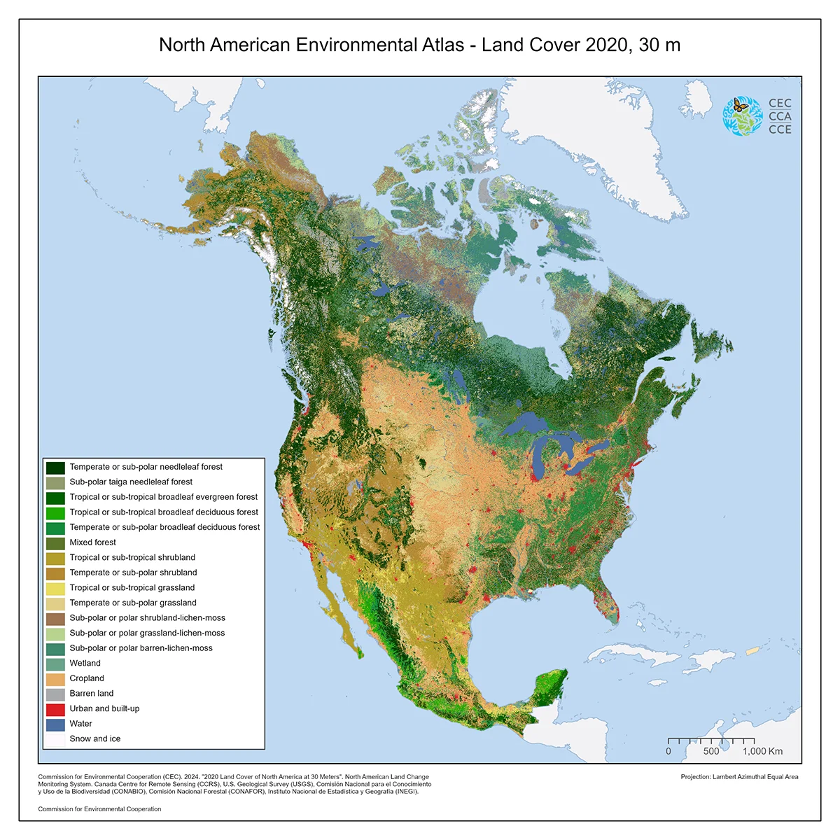
North American Land Cover, 2020 (Landsat, 30m)
2024 Land Cover
This map of North American land cover provides a harmonized view of the physical cover of Earth’s surface across the continent at a spatial resolution of 30 meters, based on Landsat satellite imagery for Canada, Mexico, and the United States.
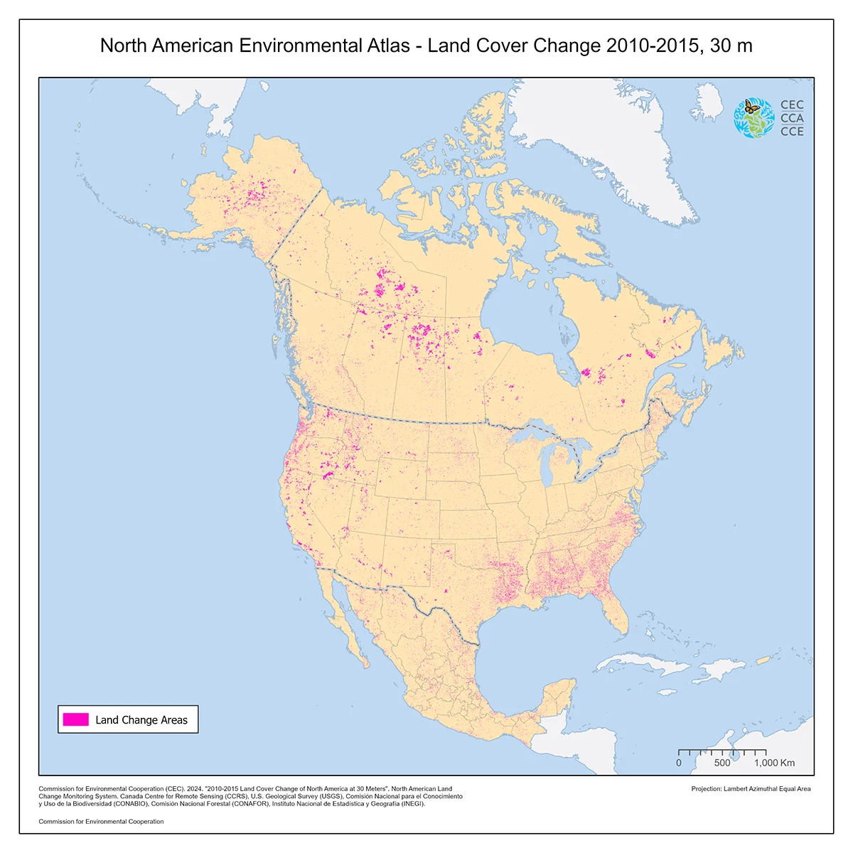
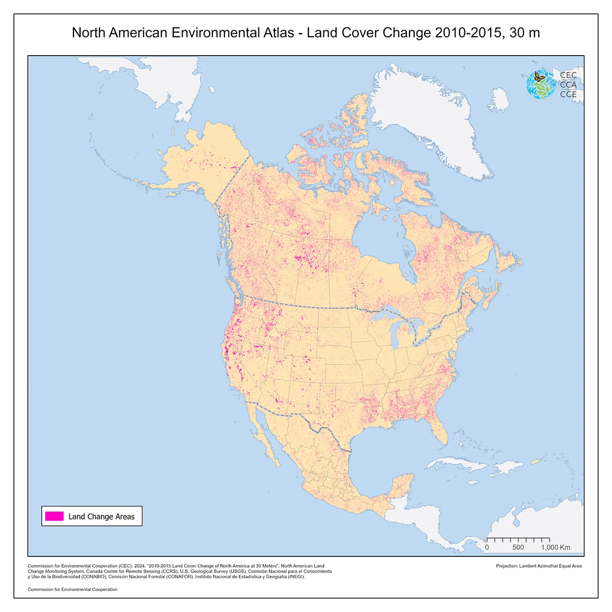
Land Cover Change 30m, 2010-2015 (Landsat)
2024 Land Cover
This map demonstrates land cover change between 2010 and 2015 in North America at a spatial resolution of 30 meters.

Land Cover 30m, 2015 (Landsat and RapidEye)
2024 Land Cover
This map of North American land cover at a spatial resolution of 30 meters provides a harmonized view of the physical cover of Earth's surface across the continent based on 2015 Landsat satellite imagery for Canada and the United States, and RapidEye imagery for Mexico.
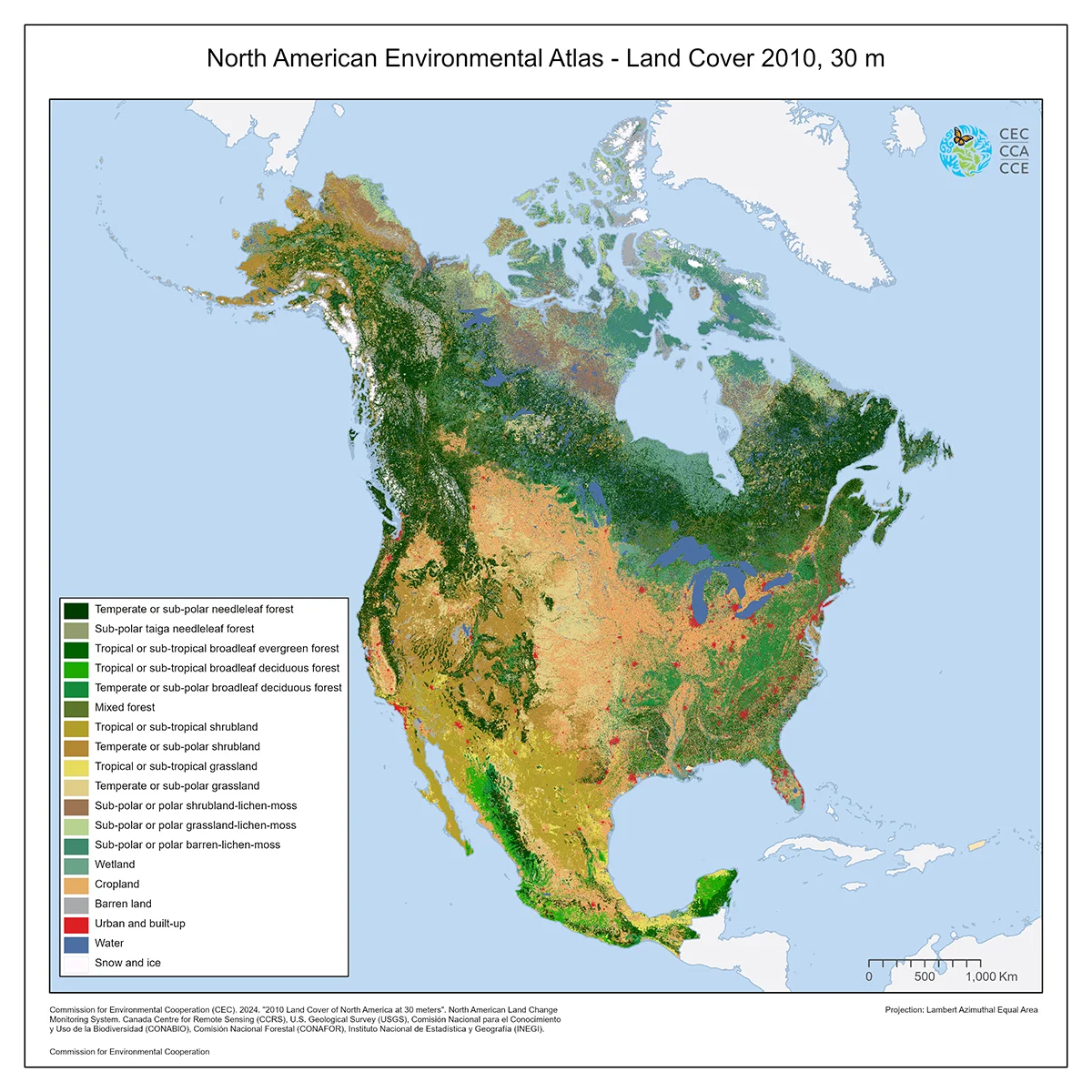
Land Cover, 2010 (Landsat, 30m)
2024 Land Cover
This map of North American land cover at a spatial resolution of 30 meters provides a harmonized view of the physical cover of Earth's surface across the continent based on 2010 Landsat satellite imagery.

Land Cover Change, 2005-2010 (MODIS, 250m)
2013 Land Cover
This map demonstrates land cover change between 2005 and 2010 in North America at a spatial resolution of 250 meters.

Land Cover, 2010 (MODIS, 250m)
2013 Land Cover
This map of North American land cover at a spatial resolution of 250 meters provides a harmonized view of the physical cover of Earth's surface across the continent based on 2010 Moderate Resolution Imaging Spectroradiometer (MODIS) satellite imagery.
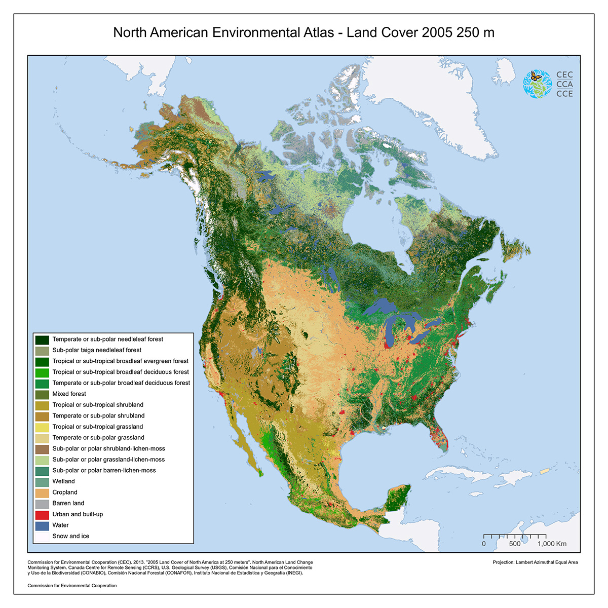
Land Cover, 2005 (MODIS, 250m)
2013 Land Cover
This map of North American land cover at a spatial resolution of 250 meters provides a harmonized view of the physical cover of Earth's surface across the continent based on 2005 Moderate Resolution Imaging Spectroradiometer (MODIS) satellite imagery.
Tools
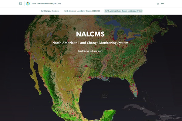
North American Land Change Monitoring System
The North American Land Change Monitoring System (NALCMS) is a collaborative initiative between Canada, Mexico and the United States that presents continental land cover and monitors its changes over time.
Publications
Here are scientific publications by North American Land Change Monitoring System experts:
IEEE Journal of Selected Topics in Applied Earth Observation and Remote Sensing
Photogrammetric Engineering & Remote Sensing
Remote Sensing of Land Use and Land Cover: Principles and Applications